Two-Sentence Summary
A south-facing Vermont building site means nothing if your winter sun is blocked by tree lines or ridges during the only hours that matter for solar gain—10am to 2pm from November through February, when the sun sits 23° lower in the sky than summer. You can't fix bad solar access after you build, but you can map winter shadow patterns in 30 minutes with free tools before you buy, potentially saving $15,000–$45,000 in heating costs over the life of your home.
If You Only Do 3 Things
- Map winter shadows before making an offer—use Sun Surveyor (app) or SunCalc (web tool) to simulate December 21 sun angles at 10am, noon, and 2pm on your potential building site; look for 4+ hours of unobstructed southern sun during these critical months.
- Walk the site in person during winter—digital tools show you the math, but boots on the ground in January/February reveal microclimates, cold pockets, and shadow patterns you can't see in summer; bring a compass and note where shadows fall between 10am–2pm.
- Identify your building envelope before you negotiate—don't assume "anywhere on the lot works"; locate the 40'x60' zone with best winter sun exposure, acceptable slope (5%–15%), and year-round access, then make sure setbacks, septic, and well placement don't force you into the dark zone.
Why This Matters
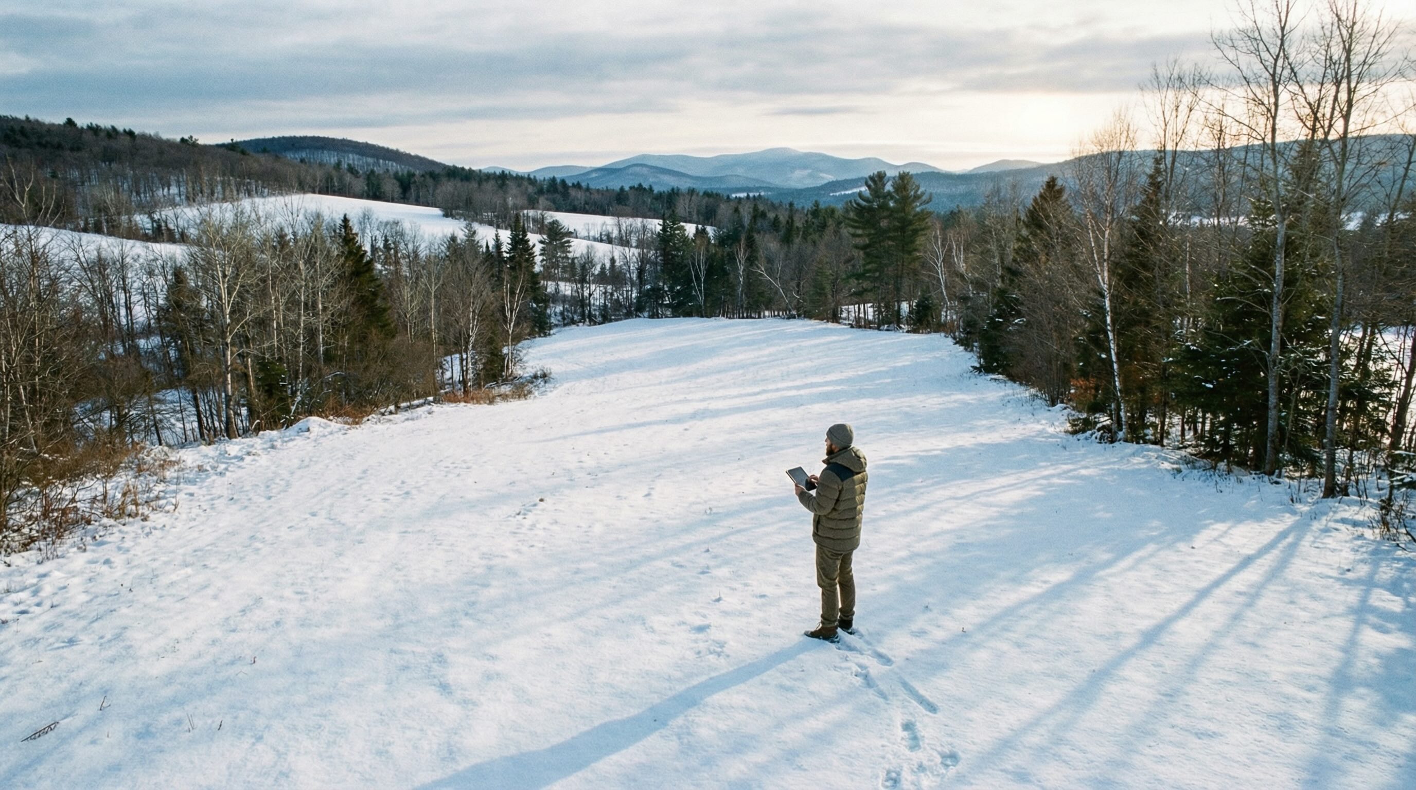
Here's the brutal math. Vermont winters demand heat from late October through April—roughly 200 days per year. Passive solar gain through south-facing windows can offset 20%–40% of your heating load if your building site gets clean southern exposure during the critical 10am–2pm window when the low-angle sun actually penetrates glass and warms thermal mass.
Block that sun and you're fighting uphill for three decades. At $0.18/kWh (approximate Vermont electric rates) or $3.50/gallon heating oil, losing 30% of your potential solar gain costs you roughly $400–$700 annually. Over 30 years at 3% inflation, that's $15,000–$45,000 in present value. And you can't retrofit solar access. Trees grow. Ridges don't move.
Translation: the "cheaper" land with mature trees blocking your southern exposure isn't cheaper. It's expensive land pretending to be a deal.
The Principle: Winter Sun Angles Change Everything
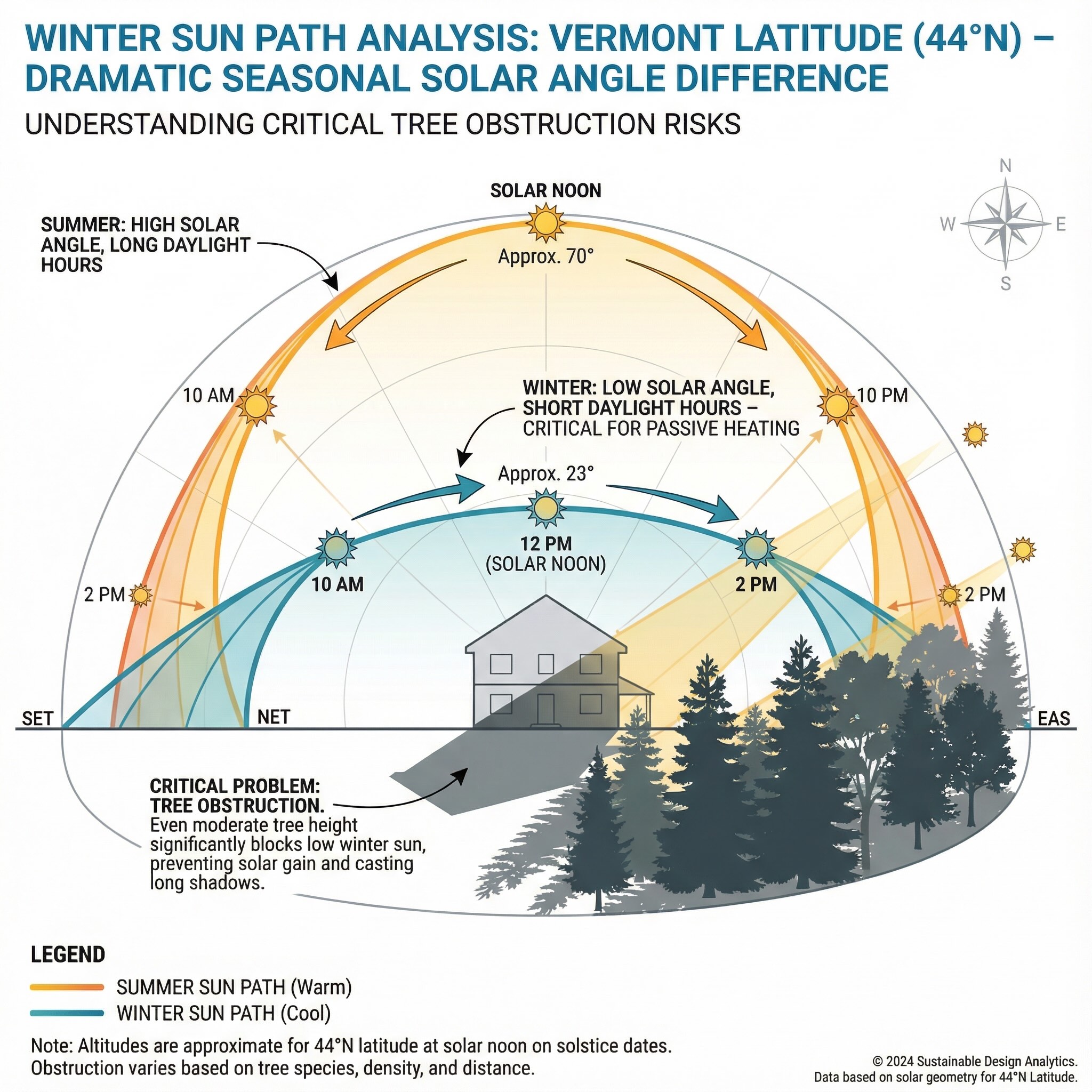
Here's what changes when the sun drops 46° in altitude. A 40-foot white pine that casts a 40-foot shadow at summer solstice (when the sun is nearly overhead) casts a 95-foot shadow at winter solstice. A ridgeline 200 feet south of your building site that's invisible in summer photographs throws your entire building envelope into shade from 7am until 11am in December.
Most buyers tour land in summer. The site feels bright, open, warm. They check "south-facing slope" off their list and move forward. Then they build, spend their first winter in the house, and realize the living room is dark until noon and cold all day. By then they've spent $400,000 and the mistake is permanent.
The fix is simple. Map winter shadows before you commit.
Vermont Reality Check: Your Site Has Microclimates You Can't See in July
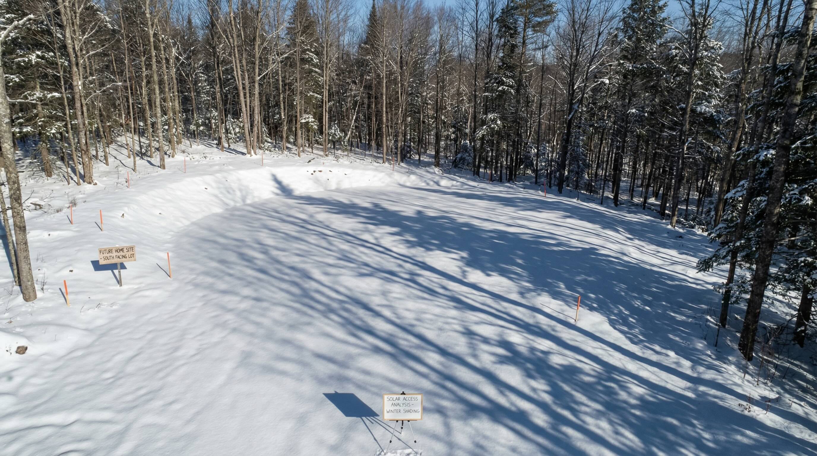
Here's what actually happens on the ground. Central Vermont's mixed forests are dominated by white pine, hemlock, and northern hardwoods. Mature pines hold their needles year-round and stand 60–80 feet tall. A 70-foot pine 100 feet south of your building site blocks winter sun until mid-morning. A ridgeline 300 feet south blocks it until noon. A neighbor's barn 150 feet southwest blocks afternoon sun after 2pm.
Add Vermont's topography. If you're building in a valley (and most buildable land in Washington, Lamoille, and Chittenden Counties is either in valleys or on hillsides), cold air drains downhill at night and pools in low spots. These frost pockets can run 10–15°F colder than ridgetop sites just 200 feet higher in elevation. Pair cold air drainage with blocked sun and you've created a microclimate that fights you all winter.
Mud season makes it worse. March and April are heating months in Vermont, but they're also when the sun finally climbs high enough to clear winter obstacles. If your site doesn't get sun until late March, you're burning fuel through the entire shoulder season when passive solar could be carrying the load.
Bottom line: if you haven't walked the site in January or February, you don't know what you're buying.
What Works: Three Moves to Map Solar Access Before You Commit
Move 1: Digital Shadow Mapping (15–30 minutes, free)
Tool: Sun Surveyor app (iOS/Android, $9.99) or SunCalc.org (free web tool)
What to do: Input the property address or GPS coordinates. Set the date to December 21 (winter solstice—the worst-case sun angle). View the sun path overlay at 10am, 12pm, and 2pm. The tool will show you exactly where the sun sits in the sky and what obstacles (tree lines, ridges, structures) block it. Look for a building envelope that maintains southern exposure during all three time windows.
What you learn: Whether the site has a viable building location with winter solar access, or if every potential building spot is compromised by shadows. This takes 15 minutes and can kill a deal before you waste time on engineering or permitting.
Cost: Free (SunCalc) or $9.99 (Sun Surveyor app)
Move 2: Winter Site Walk (1–2 hours, requires January/February visit)
Tool: Compass app, boots, and a notepad
What to do: Visit the site on a clear day between late December and mid-February. Arrive at 10am. Stand in the potential building envelope and observe where shadows fall. Use your compass to confirm true south (Vermont's magnetic declination is roughly 14°W, so magnetic south-southwest is true south). Note when the sun clears obstacles and when shadows return. Walk the perimeter of the potential building zone and identify cold spots (areas that stay shaded all day or where snow lingers longer).
What you learn: Microclimates, wind patterns, and real-world shadow behavior that digital tools approximate but don't fully capture. You'll see which trees actually block the sun (often not the ones you'd guess from summer visits), where cold air pools, and whether the site feels warm and protected or exposed and harsh. This visceral understanding changes decisions.
Cost: Time + gas money for a winter site visit. Non-negotiable if you're serious about the land.
Move 3: Building Envelope Verification (Before P&S or Contingent on It)
Tool: Land surveyor or site engineer + your digital shadow map + winter site notes
What to do: Once you've identified the optimal building envelope for solar access, verify that it's also viable for septic (primary and reserve areas), well setback (100+ feet from septic), driveway access, and local setback requirements (typically 25–50 feet from property lines in Vermont). If your "sunny spot" conflicts with septic or setbacks, you need to know before you sign a purchase and sales agreement. Make the offer contingent on site engineering verification if you're not certain.
What you learn: Whether the site actually works or if competing constraints (septic, well, access, wetlands, setbacks) force you into a compromised building location with poor solar access. Better to walk away or renegotiate price than to build in the wrong spot.
Cost: $1,500–$3,500 for preliminary site engineering (septic design, survey, well consultation). This pays for itself if it prevents a $40,000 foundation mistake or a lifetime of high heating bills.
Vermont Context: How This Plays Out in Central Vermont's Real Estate Market
Here's the pattern I see. A buyer falls in love with a 10-acre parcel on a hillside in Stowe with mountain views and mature forest. The listing photos are gorgeous—summer green, dappled light, classic Vermont. They make an offer at $120,000/acre ($1.2M total) without mapping winter sun. Then they hire an architect who realizes the only buildable envelope (given septic, well, and access constraints) is shaded by their own tree line from 7am until 11am in December. To get solar access they'd need to clear 15–20 mature trees, which kills the forest aesthetic they paid for and creates erosion concerns.
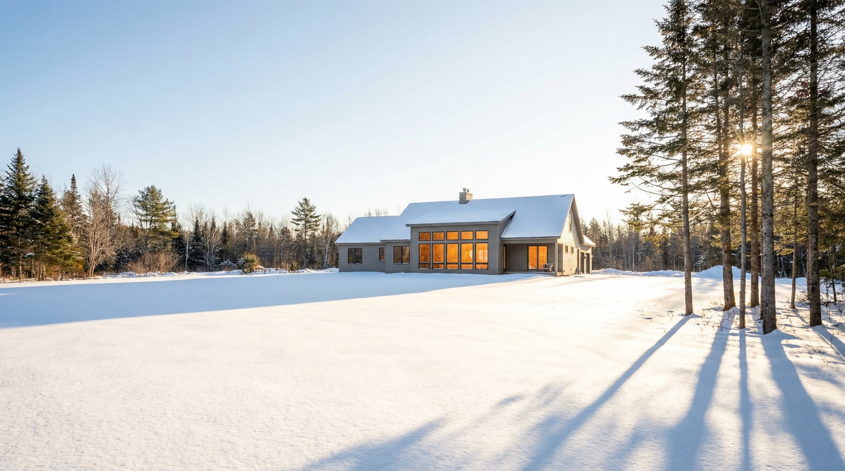
Meanwhile, a less sexy 5-acre parcel in Calais with a south-facing clearing and modest tree cover sells for $70,000/acre ($350,000 total). It photographs fine but doesn't have the "wow" factor. Yet it has 6 hours of unobstructed southern sun from November through March, which means the house they build will be warm, bright, and cheap to heat. Over 30 years, the Calais parcel saves them $20,000–$45,000 in heating costs compared to the Stowe parcel—effectively making it the better financial deal even though it "cost more" per acre on paper.
Translation: price per acre is the wrong metric. Cost to own over 30 years is the right one.
Bottom Line: Read the Land Before You Buy It
Here's your play. Before you make an offer on Vermont land, open SunCalc.org or download Sun Surveyor. Plug in the property location. Set the date to December 21. Look at the sun path from 10am to 2pm. If your potential building envelope is in shadow for more than an hour during that window, you have a problem worth $15,000–$45,000 over the life of the home.
Then visit the site in January or February. Walk the land with a compass. Stand where you'd build and feel what winter feels like on that spot. If it's cold, dark, or windswept at 11am on a sunny winter day, imagine living there for 30 winters. If that doesn't sound good, don't buy the land.
And if you find a parcel with clean southern exposure, acceptable slope, and good bones? Move fast. Those are the lots that age well.
- SunCalc.org — Free web-based sun position calculator with shadow visualization
- Sun Surveyor — $9.99 iOS/Android app with AR overlay showing sun path over live camera view
- USGS Topo Maps — Free topographic data showing slope, ridges, and elevation (usgs.gov/core-science-systems/ngp/tnm-delivery)
- Google Earth — Free terrain view showing tree cover and topography; use historical imagery to see winter tree shadows
Let's Walk the Land Together
If you're evaluating Vermont land and want to understand what you're actually buying—not just what the listing says—let's schedule a site visit before you make an offer. I'll bring the compass, the shadow maps, and 20+ years of watching people build (and sometimes regret) their choices. We'll identify the building envelope that works, the one that doesn't, and the questions you need to ask before you commit.
Tony Walton, Principal Broker
New England Landmark Realty (NELR)
Office: (802) 253-4711 or (866) 324-2427
Cell: (802) 233-4107
nelandmark.com
Where to Go Next
- Vermont Home Buying Guide — Land evaluation checklists, financing options, and site selection strategies
- Vermont Land Use Changes Explained Simply — Understanding Act 250 reforms, Tier 3 areas, and what they mean for custom builds
- Vermont Seller's Guide — For landowners considering selling acreage or improved properties
- Schedule a Land Evaluation Consultation — We'll review parcels you're considering and identify what works (and what doesn't)